We start this crucial information with the most up-to-date data from AEMET and Civil Protection so you can be aware of the risks on the road.
After a brief respite, winter weather returns in full force with storm Pedro, the sixteenth of the season, bringing us one step away from a historical record.
This new cold air mass, which is affecting the northern third with particular intensity, not only brings rainfall and a notable drop in temperatures but also activates all alarms for driving professionals. We are talking about a front that will leave wind gusts that could exceed 90 km/h and snowfall at surprisingly low altitudes, a lethal combination for road safety, according to weather reports.
The wind will undoubtedly be the main protagonist and the primary enemy for transport vehicles. Very strong gusts are expected across a wide area of the northern third of the peninsula, with warnings activated in communities such as Galicia, Asturias, Cantabria, the Basque Country, Navarre, Castile and León, and La Rioja.
In places like the interior of the Valencian Community, wind gusts could reach 80 km/h, while in mountainous areas of Mallorca, such as the Serra de Tramuntana, they could become hurricane-force, exceeding 130 km/h at the summits.
For transport drivers, this poses a high risk of veering off course, especially in areas exiting tunnels, during overtaking, and when passing other heavy vehicles. Take extreme precautions and, if possible, avoid driving at certain times in areas with orange warnings.
The danger doesn’t end with the wind. Rain and, above all, snow will further complicate the situation. Rainfall will be heavy or persistent in western Galicia, extending to the Cantabrian area and the upper Ebro.
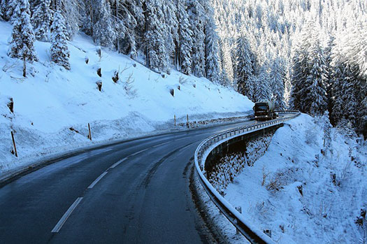
The snow level will experience a significant drop, falling to 700 meters in the northern peninsula by Thursday. This means snow can appear in mountain passes and secondary roads at low altitudes, being especially dangerous in provinces like Zamora, León, Burgos, and Soria, where it is recommended to check road conditions and carry chains. Furthermore, one must not let their guard down regarding the possible presence of ice patches, a silent risk that can surprise any driver.
Added to all this is an additional risk factor: the condition of the ground and riverbeds. The rains of recent weeks have left reservoirs at 82.5% of their capacity, the highest level in 12 years.
This means the ground is completely saturated. Therefore, Pedro’s rainfall, even if not extremely intense, can quickly cause landslides, rockfalls, and sudden flash floods in streams and rivers, as already warned by flood plans activated in several provinces of Castile and León.
Exercise extreme vigilance on roads that run through gorges, near slopes, or alongside waterways.
Finally, the call is for prudence and preparation.
For drivers of heavy vehicles, review your itineraries, pay special attention to crosswind gusts in open areas and mountain passes, and strictly respect traffic restrictions for cargo vehicles.
For all drivers in general, remember: reducing speed, increasing the safety distance, and staying informed about the forecast on your route is vital.
Pedro is the sixteenth storm of the season, and its impact reminds us that winter driving demands maximum concentration and respect for the elements. AEMET forecasts an improvement for the weekend, but until then, safety on the road depends on all of us.
Have any thoughts?
Share your reaction or leave a quick response — we’d love to hear what you think!


